.jpg)
.jpg)
Click on each picture to download a larger view.
Ngare Ndare Dryland Restoration Project.
A joint project by: Borana; Seven Ravens
Ecoforestry: and Sustainable
Agriculture Research Institute.
Borana
is a 35,000 acre ranch located on the Laikipia Plain, Kenya.
Traditional use of this ranch has been livestock farming of cattle, sheep
and goats. Observations over the
years concluded that the damage created by the goats and sheep was too great.
The severe pressure on wildlife throughout the country from poaching and
habitat destruction instigated the owners to adapt the property towards wildlife
management. Selective
cattle-grazing has helped to manage and improve grasslands for the wildlife. Top
end tourism has provided the income to subsidise the cost of wildlife
management.
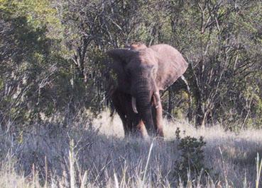
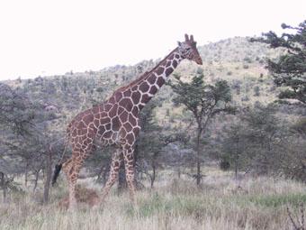
Two of the many
species of animals to be seen at Borana ranch.
In
the interest of preserving and enhancing the local environment they have started
working with the local communities in setting up eco-tourism as an alternative
source of income. Forest
preservation and improved utilisation have been key elements.
Il N’gwesi and Tassia are two examples of successfully run eco-tourism
projects. In spite of the
ecological benefits to these two areas, the Maasai have transferred their
animals to other areas where new degradation is happening.
Michael
Dyer from Borana decided that he wanted to create a demonstration project on a
very denuded piece of land and so asked Michael Nickels (an eco-forestry
consultant from Canada with ten years of land restoration and nursery
development experience in Kenya) and Jeff Nugent (a permaculture consultant,
teacher and author from Australia) for their assistance.
The
property has been fenced to prevent wildlife, particularly elephants, from
invading agricultural land to the south. To
streamline fencing an area of about 13 hectares was excluded from fencing.
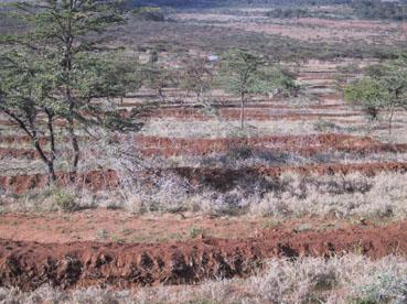
This is the site of the project. It
sits between the fenced Borana ranch, the Ngare Ndare Forest and the Ngare Ndare
village.
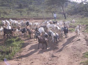
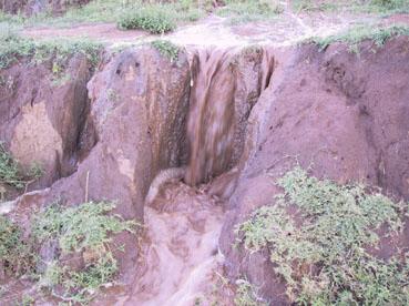
The daily traffic of thousands of animals and the
gathering of fuel-wood cause severe land degredation.
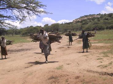
The villagers use the project site as a short cut to the Ngare Ndare Forest where they run their livestock and collect firewood. They also harvest firewood and other products such as bark, honey and aloes. The impact on the site is pronounced. Most of the vegetation has been removed and the soils are heavily compacted by stock

Gully erosion is severe and would continue to
worsen if nothing were done.
The
objects of the project are:
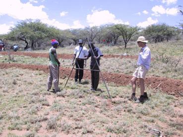
In
establishing the model it will be important to keep all of the examples within
reach of the local people. Where
machinery is used to hasten development, similar work will be done by hand,
employing local people. These
people will learn the skills by doing. At
every stage of development workers are taught why a task is being performed
giving them a broader understanding.
It is hoped that some will take these acquired skills and apply and
develop them on their own places. It
is also hoped that some will derive employment using their newfound skills.
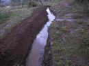
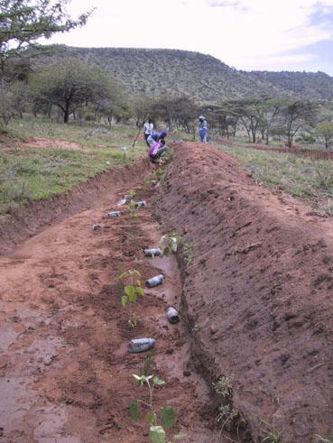
The
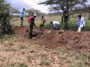
first priority once the site is secured is to halt erosion.
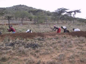
To this end a series of swales have been built onto the site.
In the early stages a combination of lack of understanding by the workers
and a 40mm rainfall event in about 30 minutes resulted in some of these swales
washing out. This has been a good
lesson to all involved.
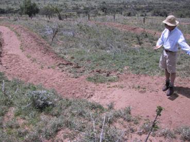
Repair work and swale building will now be done under
strict supervision.
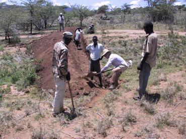
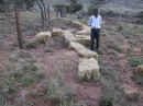
Hand-dug
swales were planted to trees or tree seed and protected with acacia branches,
pruned on-site to improve the long-term timber potential of those trees.
The
site will trial many species with potential to feed people and livestock and to
provide basic human needs such as food, shelter, fuel-wood, fibres and
medicines. Some of these species
will be indigenous to the area, but many will not.
The species will be planted so as to avoid monocultures and to maximise
conditions such as shade, sun, soil and water.
They will also be arranged so as to maximise their products and
functions.
Once
established, the more successful species will be propagated so as to provide
nursery stock to the village.
Field days have been held to explain to the villagers the importance of the project and the need for their co-operation.
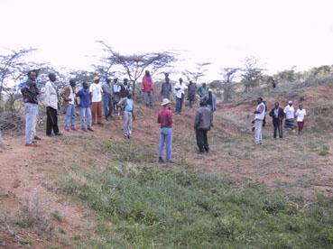
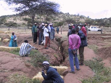
Approximately 100 Interested community members came to
a field day.
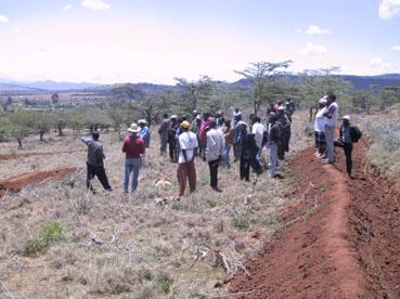
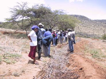
Community Field Day April 12 2002.
A
house will be established with a resident manager.
The house roof will serve as water collection for domestic use.
Water for garden use will be from a small dam, which will collect water
from the road. The dam will
initially trial a system of sealing known as gleying. Straw will be spread
around the dam and as the rains start a large number of sheep will be fenced
into the area and fed a good diet. The combination of the manure from the stock,
the resulting microbes, the compacting effect of the sheep’s feet, and the
rising water level will contribute to seal the dam.
This process is within reach of the local people and does not rely on
expensive non-renewable resources.
The
day the swales were completed (April 19th 2002) 40mm of rain fell on
to the project site in 20 minutes. This
was truly a test to see how the swales would hold up.

5 million litres of water saved from eroding more soil and
allowed to penetrate deep into the earth.
These are ideal conditions for tree development.
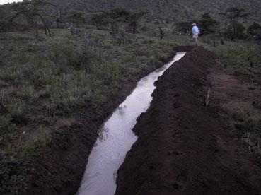
Only 3 week earlier all of this water would have rushed off the land to the
river with tonnes of top soil.
A few swales suffered some damage, but the system retained
its integrity. Damage was repaired.
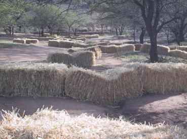
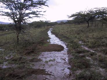
The straw bales placed strategically throughout the project site worked
effectively, building deep layers of topsoil eroded from uphill.
Some
bales are brimming with banks of new topsoil and more bales are needed before
the next major rain. The cost of
bales is a topic, which has been extensively discussed, but it is obvious from
this experience that this is a most worthwhile investment.
For the farmer it means a new ‘instant’ terrace of rich soil, which
can bring financial returns in about four months.
It also offers some insurance against crop loss due to flash flood.
The
seeds, which were planted a few days earlier, began emerging.
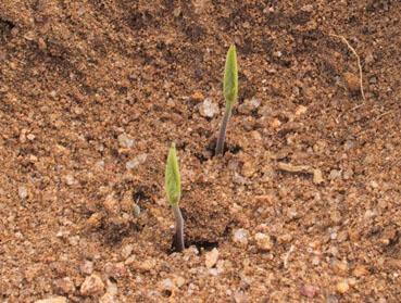
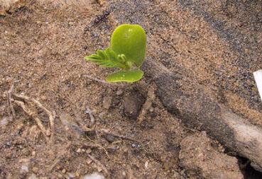
Hundreds of thousands of seed have gone into swales
and into net and pans. Pigeon pea
emerging on swale walls (left) and sprouting tamarind in net and pan (right).
Thousands of trees were planted throughout the site.
Over
80 species of multi-purpose trees have been planted (see
appendix 1). Many of the trees
were purchased from the local community tree nursery.
Seed of all of the species on trial have been provided to this nursery to
be grown ready for the next rainy season.
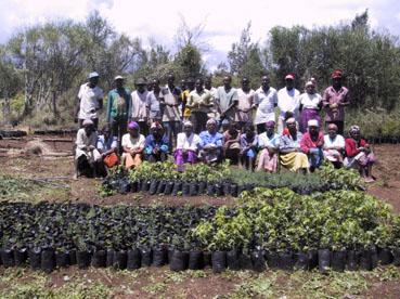
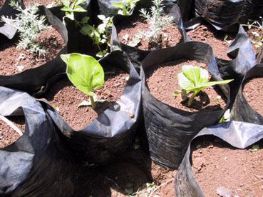
Left: Community Nursery members. Right:
Young baobab are
the first to sprout of the many species of seed provided to the nursery.
Vetiver
grass has proven difficult to source and is still to be planted.
The absence of this grass in the district suggests a market for a local
nursery.
Sisal
will be planted in two rows, staggered at 1 metre spacing all along the fence.
In between the sisal, Kei apple (Dovyalis caffra) and Ximenia
americana will be planted. Both
these plants produce edible fruits and together with the sisal will make an
impenetrable barrier as a secondary fence.
The
site provides a perfect location for holding educational workshops.
An interperatation centre will be set up in the future so that groups
coming through can be shown videos and be toured around the project.
The adjacent school has requested that a similar approach be implemented on their grounds next year. In the long-term interest of this project, education will play a key role.
It is hoped
that workers who have acquired new skills will be employed in land restoration.
Some
of the industries which are likely to come on stream in the future include:
honey production; seed harvesting, sorting and packing; vegetable and
fruit production; building materials; medicinal products; fibres and basketry;
papermaking; and charcoal to name a few.
The
wider benefit is to the community in terms of a model of stable land management
and food security. It is hoped that
the demonstration plot will be a catalyst in reversing the alarming trend of
land degradation in the region. This
demonstration has been privately funded and the aim is to seek additional donor
funding channelled through Laikipia Wildlife Forum to implement similar projects
throughout the area.
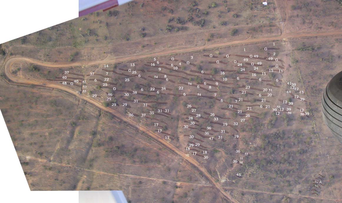
Click photo for aerial view (110K). Numbers on photo refer to planting.
See Ngare Ndare Rainfall Records